July Fourth Weekend Photo Road Trip to the Eastern Sierra Nevada: The Dismal Side of the Sierras, Part 4
Mono Lake, Milky Way, Sunrise
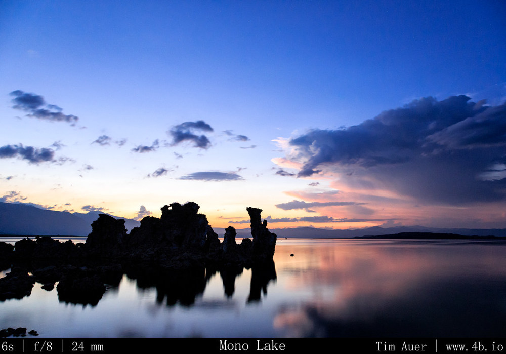
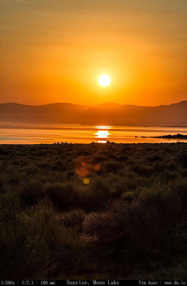
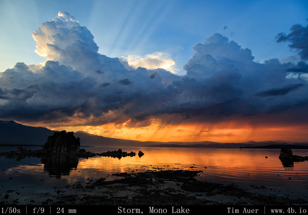
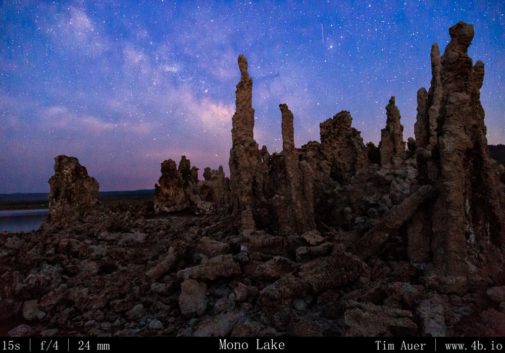
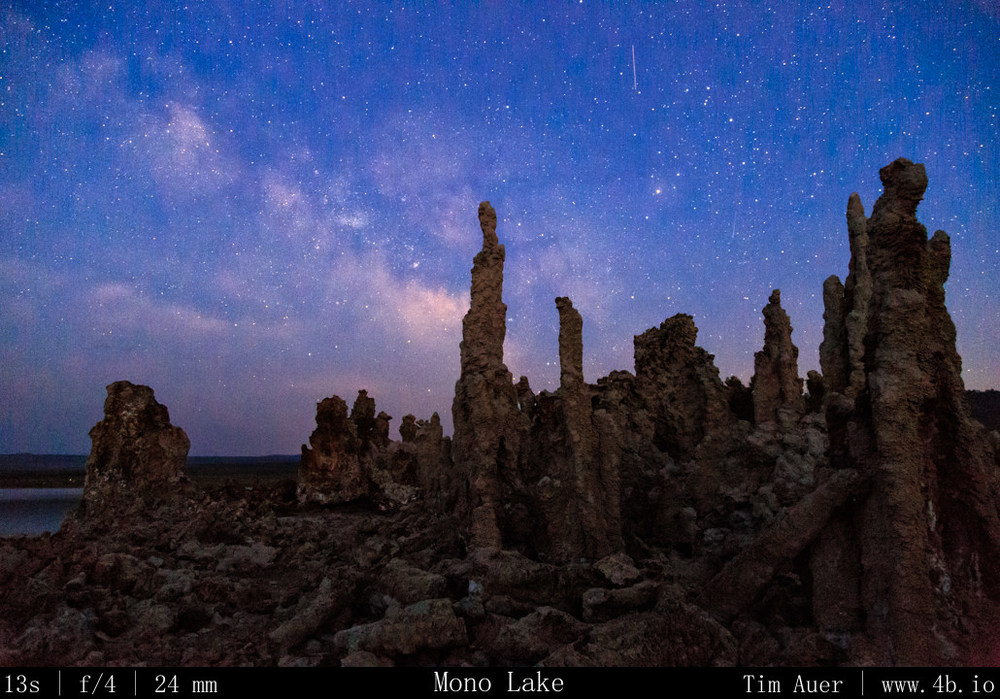
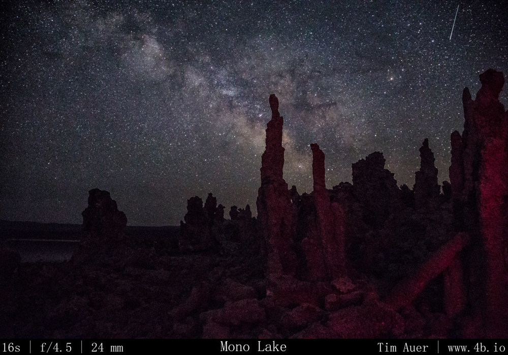
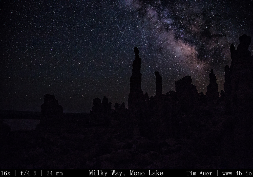
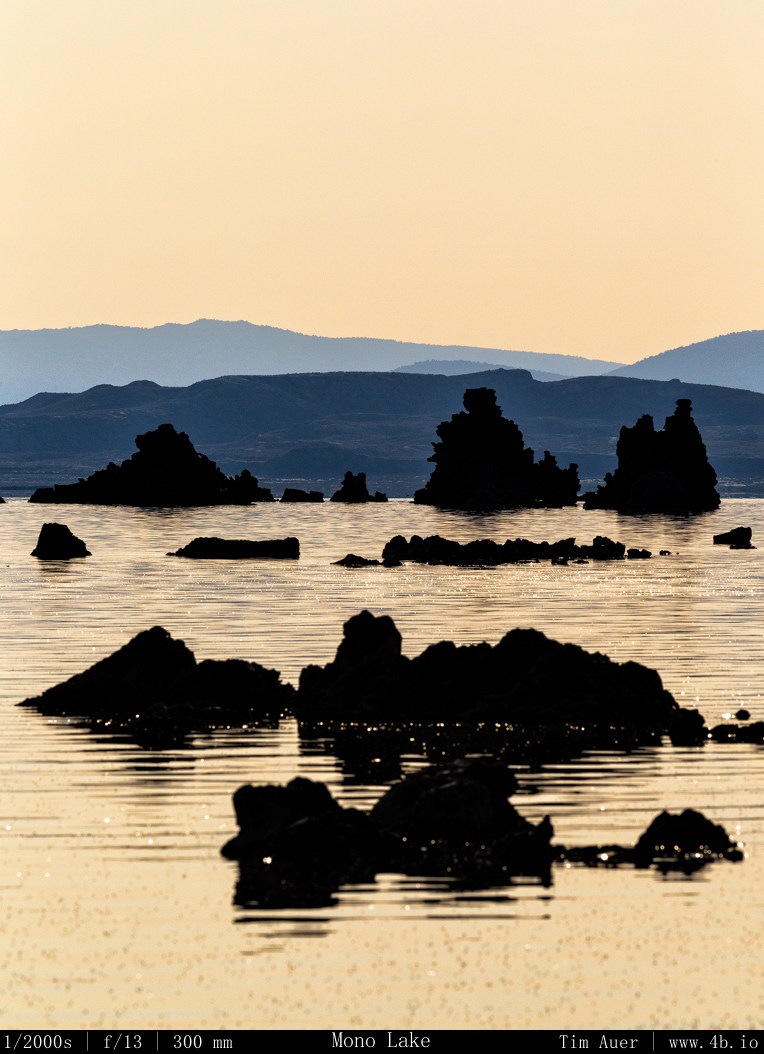
After finishing up at Bodie, I made my way back towards Lee Vining and Mono Lake for the evening astrophotography session. As I ate dinner at “Bodie Mike’s” in Lee Vining, I received several imminent flash flood warnings for Mono Lake. I decided to scrap my original plan: an all night time lapse while sleeping under the stars next to my camera, and go for something a bit less ambitious. Fortunately, the storms cleared in time for sunset. I was rewarded with a great sequence of sunset images and stayed out til about 01:00 capturing the Milky Way with tufa in the foreground. Throughout the night I heard coyotes howling and yipping, owls hooting, and bats echo-locating.
Dark skies abound.
Photography: Milky Way captured using wide aperture (f/4.0, f/4.5) , high ISO, and the shutter speed defined, at the maximum, by the “rule of 600”. Before sunset I set up the 6D at 24mm on tripod facing north west for time lapse footage. The cloud formations were dynamic and interesting. You could tell that while the sun was up, the storms were still being fueled, but as the sun dropped, the fluffy, anvil shaped Cumulonimbus clouds collapsed in on itself in a pink display.
Once the color was drained from the western sky, I recomposed the 6D for the Milky Way. I did this during civil twilight because I wanted there to be enough ambient light left to maintain the auto-focus capability for the entire scene (fore and back). This helped me to avoid wasting valuable minutes incrementally tweaking the focus manually in the dark. Facing SSE (direction of Milky Way’s rise) and including some Tufa in the foreground, I focused camera on my scene, switched lens to manual focus, and began the time lapse of Milky Way. At first I was in Aperture Priority, but when the shutter speeds began to increase to over 15s in the darker conditions, I switched from Aperture Priority to Bulb Mode. I set my intervalometer to hold the shutter open for 20s each exposure, and upped the ISO mode. Now in steady-state, I left the camera do its thing, checking it from time using the 6D’s Wifi image viewer features on my phone.
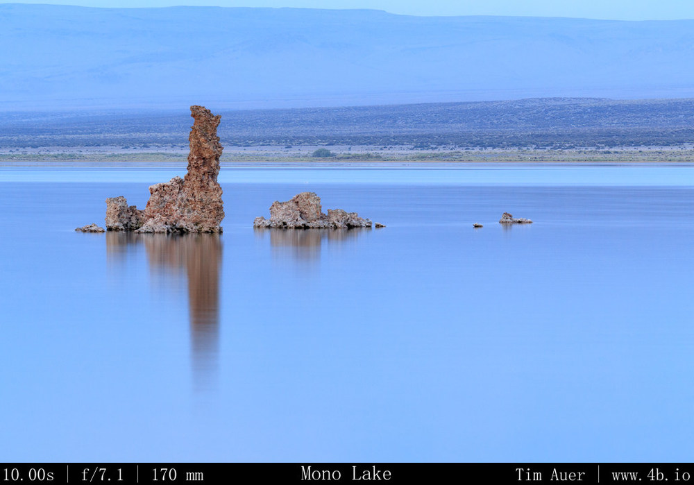
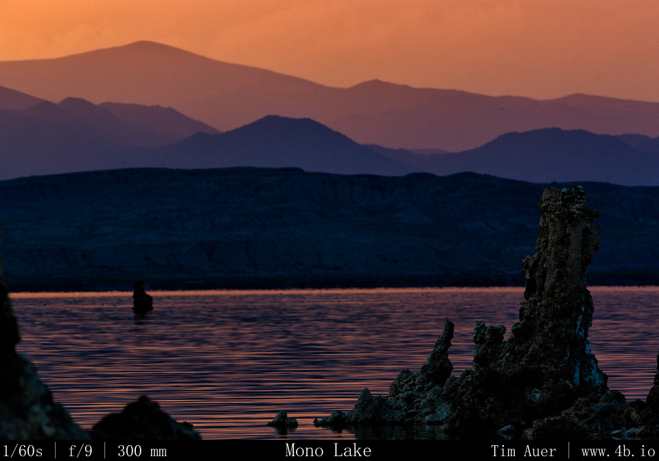
My second camera , the 1D, had a telephoto lens on it. I used this for isolation shots of specific tufa outcroppings and compression of the lake with mountains and scenery across the lake.
July Fourth Weekend Photo Road Trip to the Eastern Sierra Nevada: The Dismal Side of the Sierras, Part 3.
Mono Lake, Bodie State Historic Park
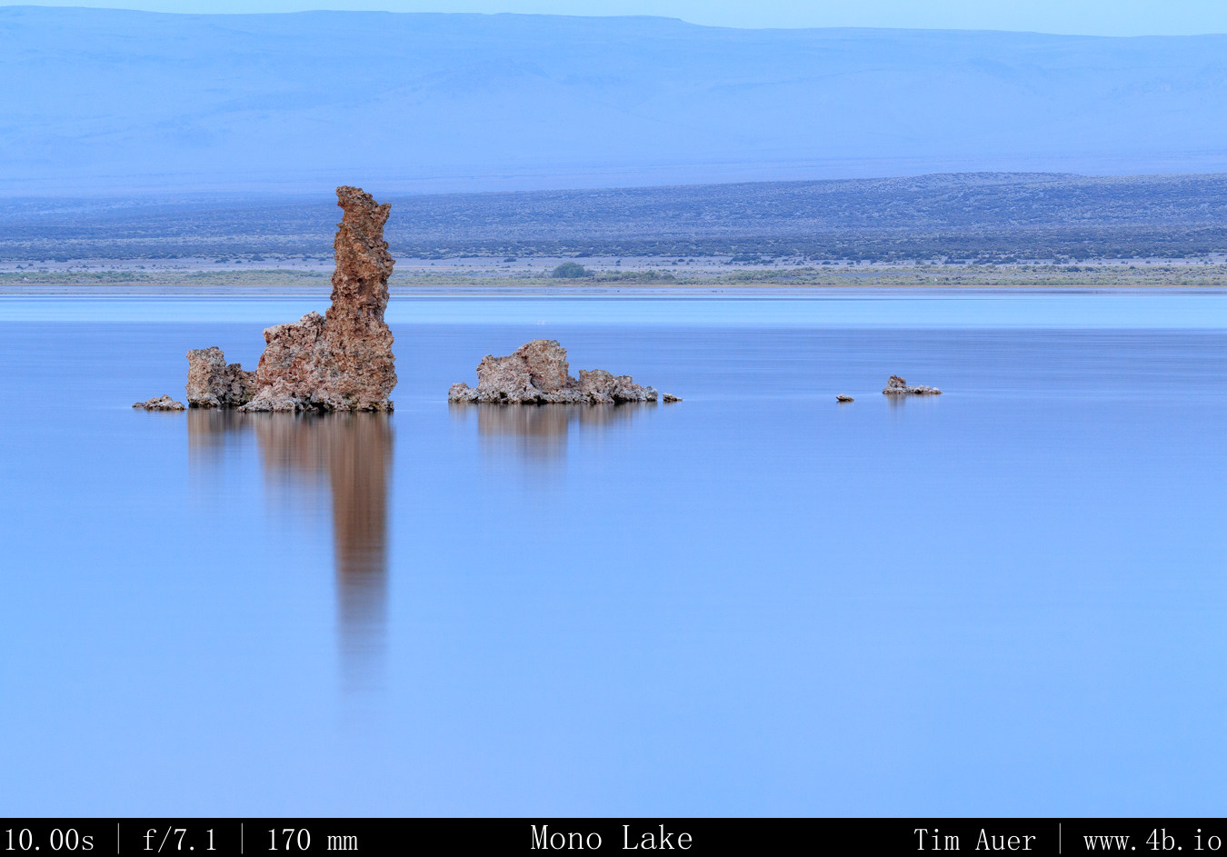
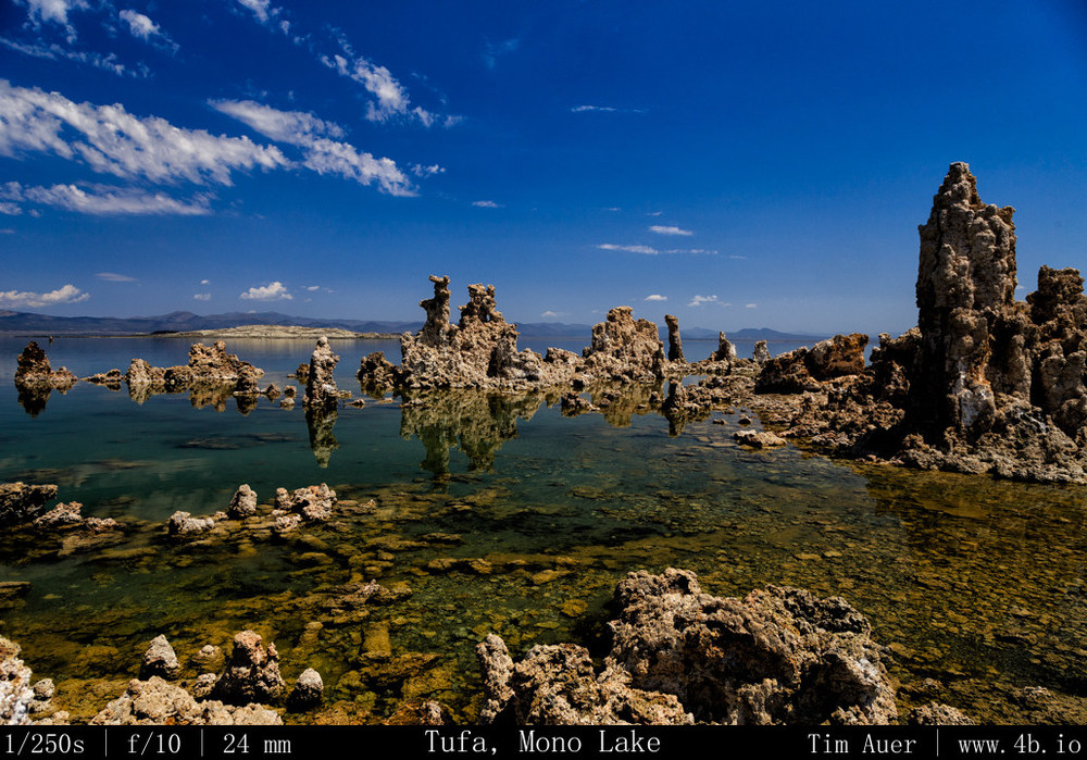
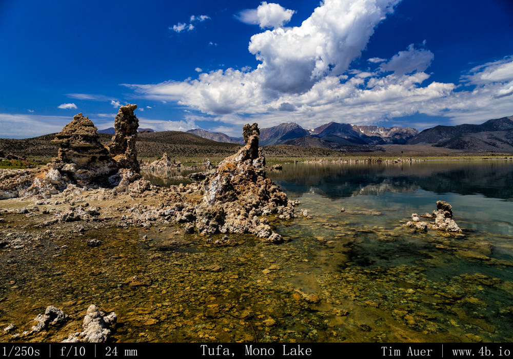
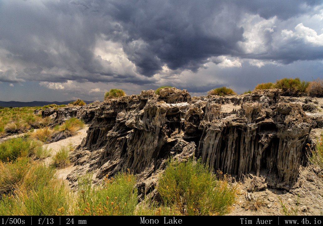
Thursday, July 4, 2013 A “Tufa” is a rock formation that forms under water at the site of a mineral rich spring. They can be thought of as petrified springs made of calcium and carbonate, or limestone. Many of the exposed Mono Lake Tufas are geologically young, being only 600 years old. All of the formations are extremely fragile and readily crumble to dust if trod upon. Care should be taken to not touch or step on these formations.
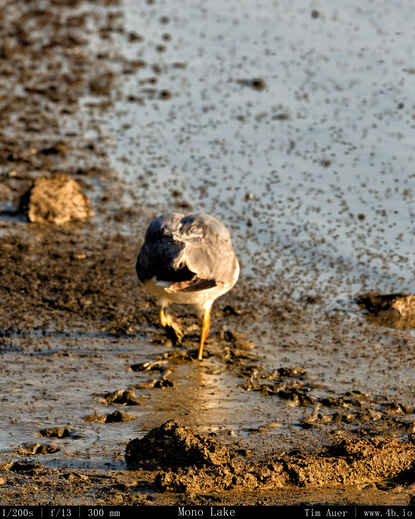
Note the Alkali flies in foreground on the lake surface
The highest concentration of tufas at Mono Lake are at the South Tufa Area. Coincidentally enough the South Tufa area happens to be on the southern side of Mono Lake. This presented me with a challenge: due to the SSE rise of the galaxy (see previous post), I knew it wouldn’t be easy to find a land based vantage point that included both the lake + tufas in foreground. I spent the rest of the morning and into early afternoon contemplating the photographic possibilities. Walking along stretches of the north, west and south shores of the lake, I scouted potential sites. Despite the challenges of the south-side, I settled on a couple locations in South Tufa, and one spot near Navy Beach with “sand tufas” as potential spots, and noted their positions. Later on, due to the weather, I was relieved to have these multiple options. With my scouting finished, it was time to drive to Bodie State Historic Park and explore the ghost town for the rest of the afternoon.
Tufa on Mono Lake
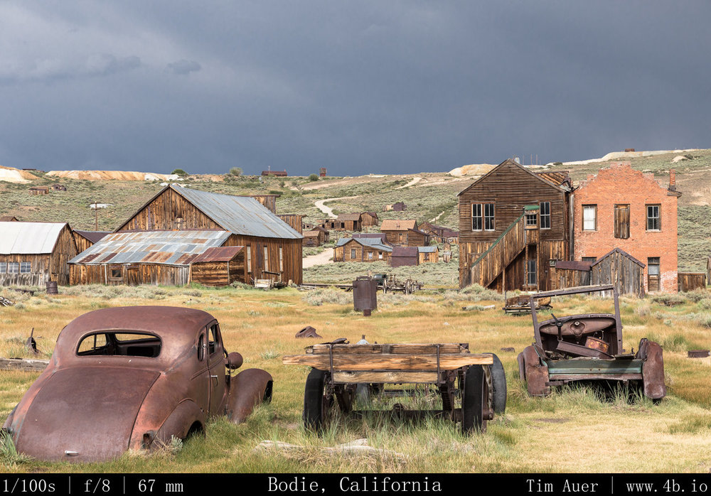
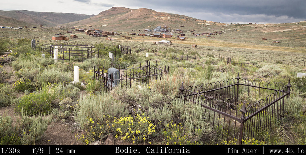
By afternoon, thunderstorms came to the area and seemed to just hang there. I am not familiar with the weather patterns of the eastern Sierra yet (something else I hope to learn), but suspect the higher than average humidity in Mono Lake area had something to do with it (50% relative humidity is considered muggy here). Thunder began to rumble in the east as I left Lake Mono, and continued rumbling the entire time I was in Bodie. On the drive to and from I hit pockets of downpours and quarter sized hail.
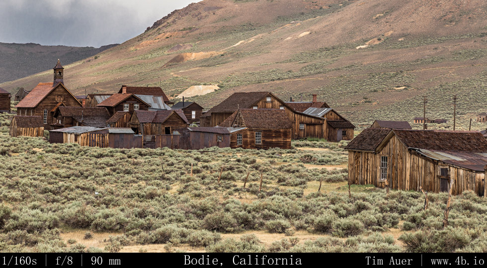
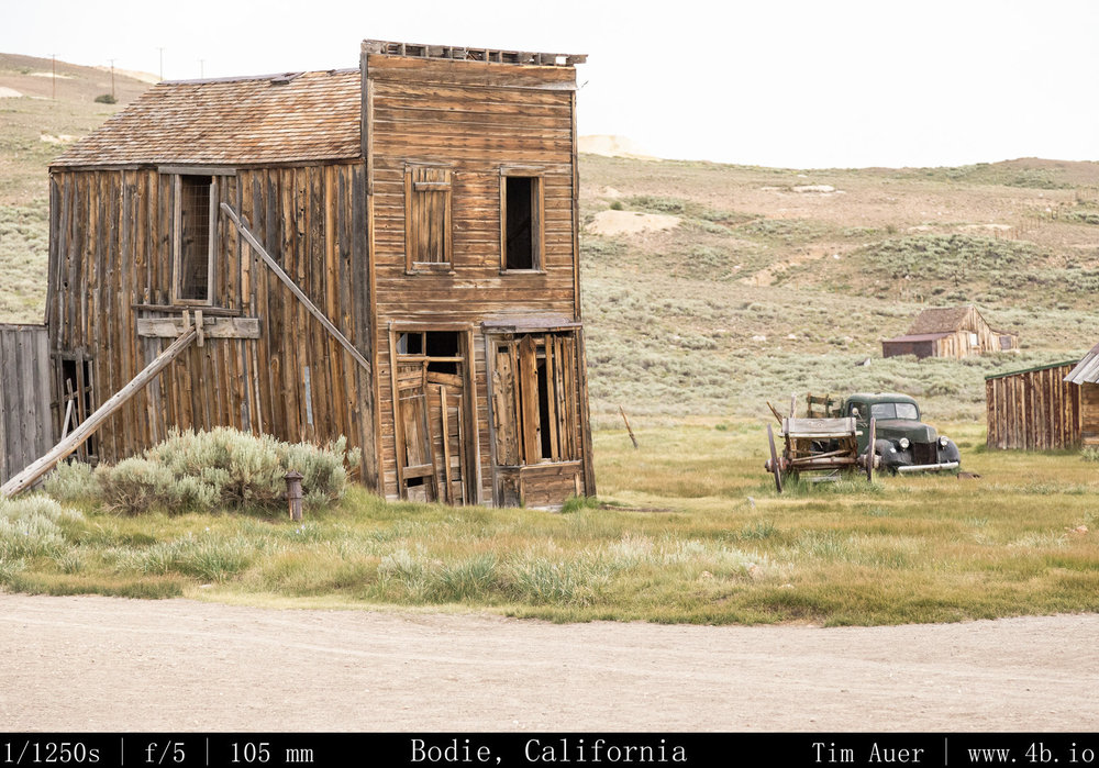
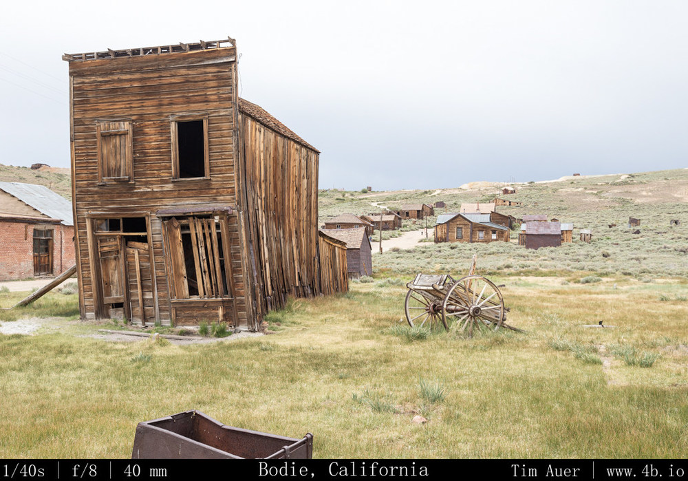
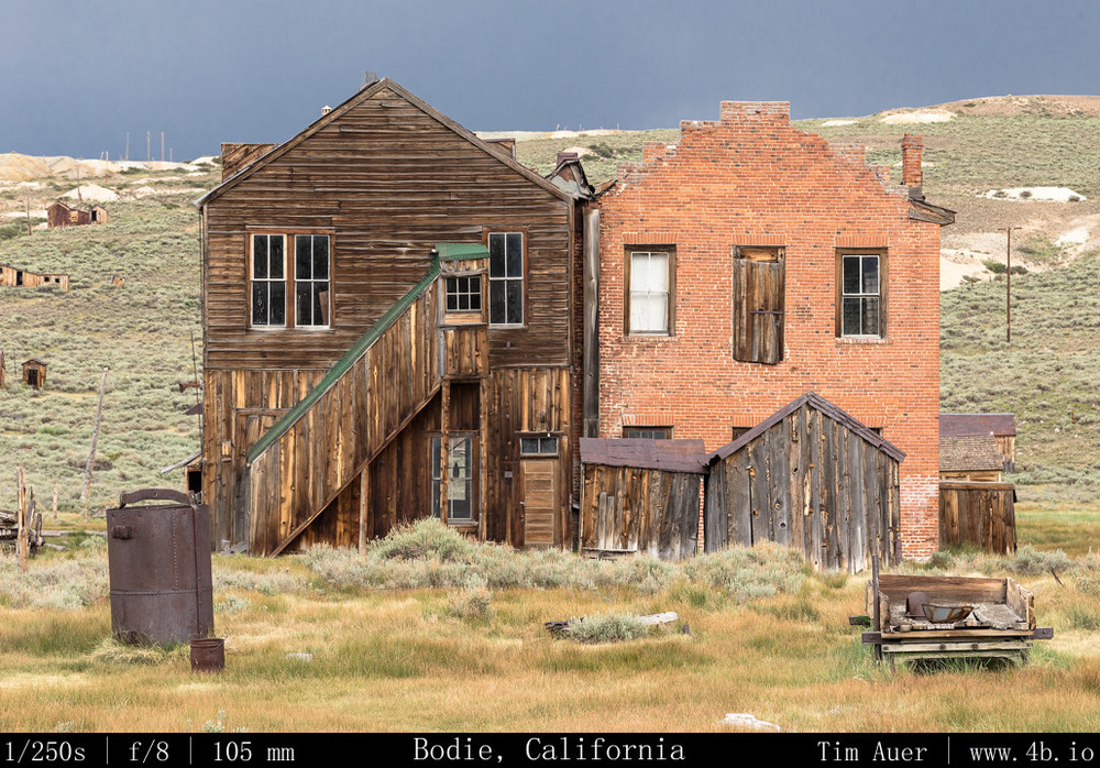
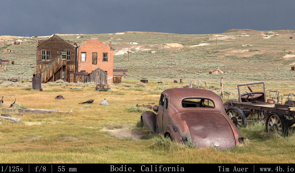
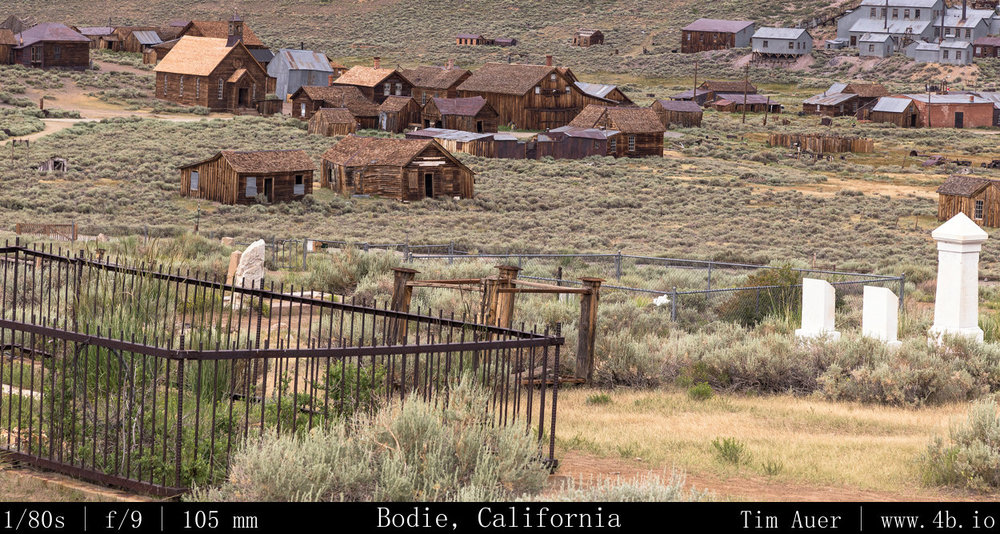
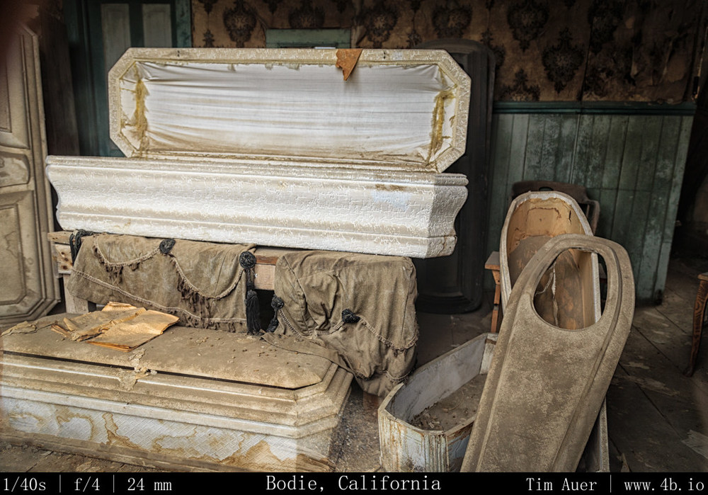
Bodie Ghost Town was really neat! It made me feel like a kid again, and I wished I had worn my cowboy hat and rode in on a horse with a BB-gun strapped across my back. To be honest, considering the road conditions leading up to the town at its 8400 ft elevation, a horse would may have been the better way to travel. The final seven miles of road are unpaved and very rough. Upon my arrival at around 14:00, the town was crowded, but seemed to be slowly clearing out, I expect the lingering storms and Fourth of July plans were responsible. I wandered the town for a several hours, contemplating what life was like at the height of this 1880s gold-rush boomtown.
What struck me as especially interesting was the sheer impracticality of the town, especially in winter. It would be an understatement to describe the climate as being harsh. The combination of exposure and high elevation makes Bodie one of the coldest spots in the lower 48, with routine 100 MPH winter winds. Keeping warm in a thin-sided house without insulation required a lot of firewood, and the town burned 100,000 cords each winter. Problem was there are no trees growing on the windswept Bodie hills, so a railroad was built to connect Bodie to a lumber mill near Mono Lake. I guess these hardworking miners coped with this climate by adopting a hedonistic lifestyle, evidenced by the town’s featured recreational opportunities. Which seemed to consist of heavy drinking at one of the ninety(!) saloons, smoking opium at a den in Chinatown (yes, there was a Chinatown), or patronizing your favorite whorehouse (which were conveniently located directly behind or connected to those saloons). So given the town’s economy and its wild-west lifestyle, it comes as no surprise that life there was unsustainable when the mines ceased to provide precious metals. The miserable winters probably didn’t convince people to stay either.
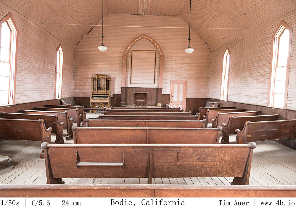
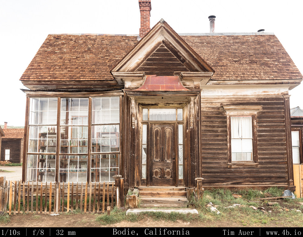
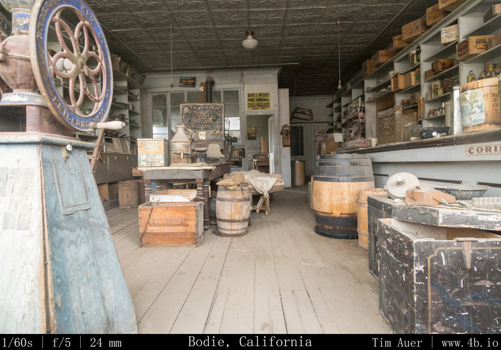
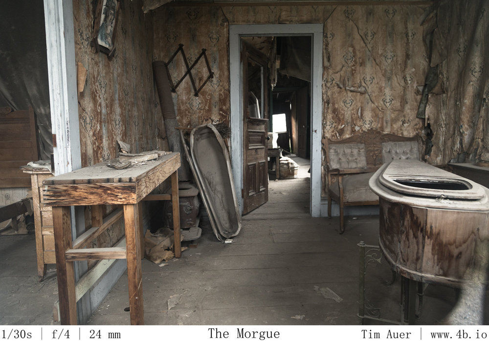
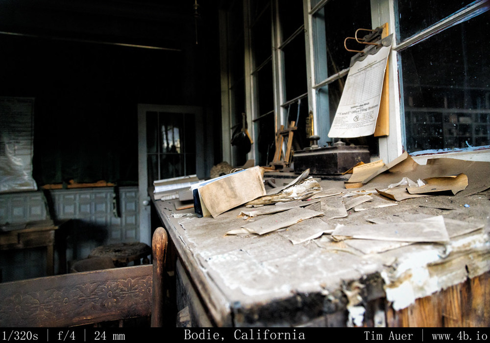
I feel it is also important to mention, this not a Disney-fied theme park. There are no props, the artifacts are not staged. All the objects you see while peering through the windows were found somewhere inside that respective building.
For those not familiar, Bodie State Historic Park contain remains the old mining town Bodie. At its height, before the turn of the century, the town housed 10,000+ inhabitants. This heyday turned out to be short lived and the residents began to leave about as quickly as they had arrived. While a few stranglers toughed it out a few decades into the next century, the majority did not. Businessman J.S. Cain bought up most of the township and surrounding mines as they became available, and actually squeezed bit more profit out of the hills, extracting gold and silver left behind in the first wave. He also made an effort to preserve and protect his hometown from vandals and the elements and leaving us with the wonderfully preserved Ghost Town we have today.
In terms of my visit and the photographic opportunities, I was rewarded with empty streets and soft light, courtesy of the storm clouds. I exposed to right by a 1/3 or 2/3 of a stop to emphasize the warm brown tones of the wooden structures, and waited for the few moments when the sun peaked through the clouds for a bit of dramatic lighting. This place is really cool and would be worth a visit even with harsh light and jammed streets.
Highlights: Church, general store, car graveyard, boothill, bank vault, human graveyard.
July Fourth Weekend Photo Road Trip to the Eastern Sierra Nevada: The Dismal Side of the Sierras, Part 2
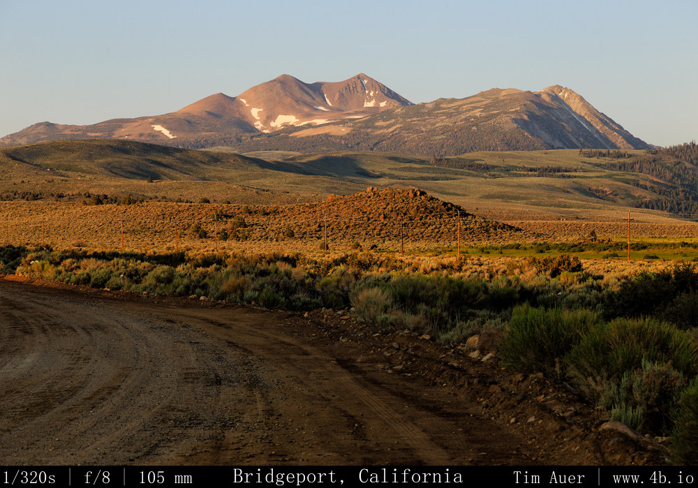
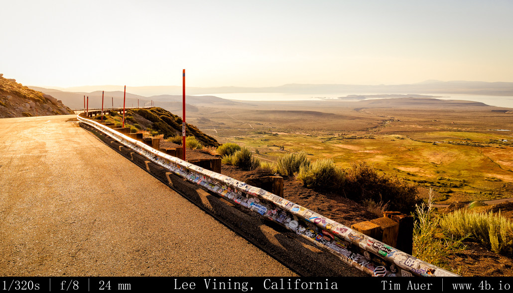
Bridgeport, CA; Mono Lake; Lee Vining
Wednesday, July 3, 2013
After finishing work and taking a two hour nap Wednesday evening, I reset the odometer on my car and departed Mountain View at 20:30 Wednesday night. By leaving late, I hoped to miss the holiday traffic, wishful thinking of course. Delayed by the congestion, I drove for about 6 hours, crossing the Sierras at Sonora Pass on Rt. 108 at approximately 01:00 Thursday morning. This isolated road is not particularly fun to drive in the dead of night. It is extremely windy, narrow, strewn with rock debris, and 26% road grades on both sides of its peak. I kept it in 2nd gear in these stretches. One hour after crossing the pass, I was driving through Bridgeport, CA and decided called it a night, so I pulled off at Green Creek Rd and took a rest. The 2AM sky here was clear and bursting with stars. I knew this was going to be a worthwhile trip!
Thursday, July 4, 2013
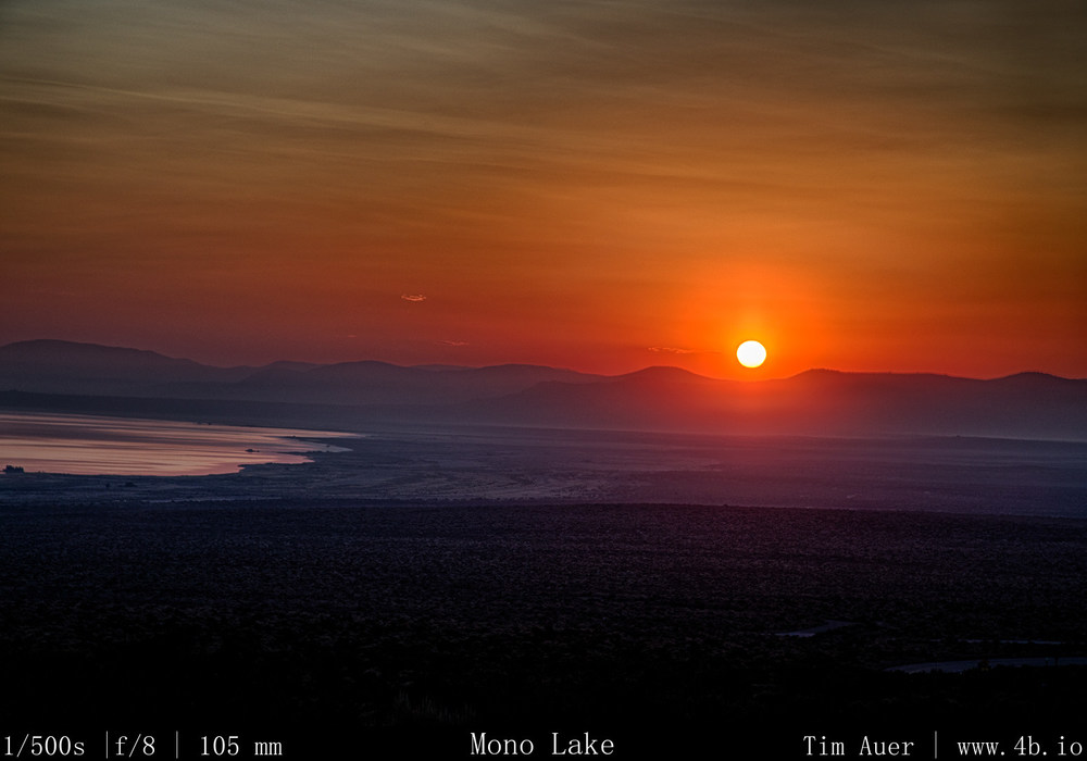
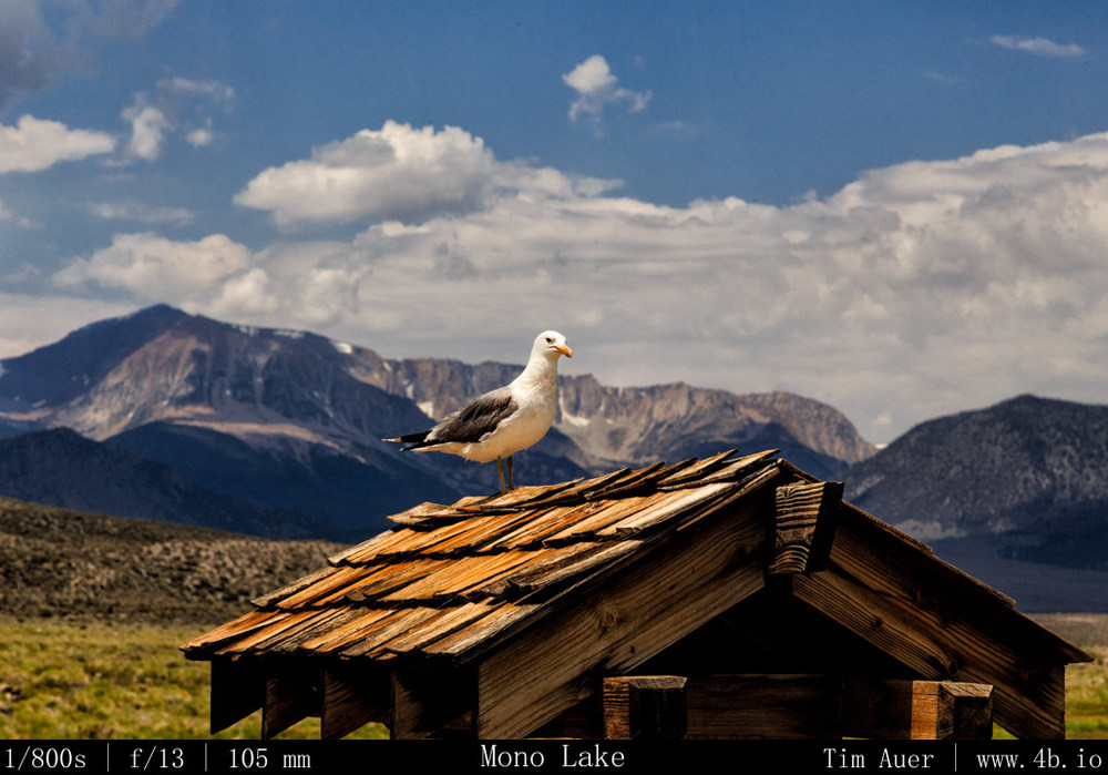
I woke up at 05:00 when farm vehicles rumbled past me on the gravel road. I felt awake and refreshed. In the twilight of dawn, I took in the scenery of the Hoover Wilderness to the west of me and felt even more invigorated. I ate an apple, brushed my teeth, and was on the road by 05:30. Mono Lake was my first destination. On my approach I stopped at some of the vista points along 395 and arrived to the lake at 06:15. Already too late for sunrise, I stopped first at Old Marina and watched the California Gulls dance in the mud to catch Alkali Flies. But having missed sunrise, I mostly took the morning easy. Had breakfast at Nicely’s in Lee Vining and went on the morning ranger walk at the South Tufa Area. Now with a deeper appreciation of the lake, I began to scout positions for the evening’s photography session….
July Fourth Weekend Photo Road Trip to the Eastern Sierra Nevada: The Dismal Side of the Sierras, Part 1
Locations/Sites: Bridgeport, Mono Lake; Bodie Ghost Town; Inyo Mountains; Lone Pine; Alabama Hills; Mt. Whitney; Bishop; White Mountains; Bristlecones; Death Valley (glimpse); Volcanic Tablelands; Red Mountain Petroglyphs; Yosemite(brief) In total: 1022.5 driving miles.
see maps below for details
When:
July 3 @20:30 – July 7 @12:30.
Background
To be clear, there is nothing “dismal” in the conventional sense about the backside of the Sierra Nevada, its my preferred side. This region, from Mono Lake through the Owens Valley to Lone Pine, is a special, timeless place, like nowhere else I have ever visited. I call it “dismal” because this rain shadowed strip of land, flanked on both sides by 14,000 ft. peaks, is a harsh and unforgiving environment, dotted with ghost towns, sage brush, salty alkali lakes, rattlesnakes, and tumbleweed. Surviving here is not a trivial undertaking, and most humans are not up to the challenge, as evidenced by the ghost towns. Yet in the midst of such adversity, life exists, sometimes thrives. The ancient Mono Lake, sometimes called a dead sea, teems with life. The Earth’s longest lived organisms are found here, the Bristlecone pine. Some of these spectacular trees took root in the nutrient poor dolomitic soil of the White Mountains hundreds of years before the first pyramids of Egypt went up, and still hold onto life to this day. Of course, not all Bristlecones last over 5,000 years. There are special considerations to account for such longevity, but it might not be what you expect. Lower elevation Bristlecones, with the relatively abundant resources, are not nearly as long lived as their resource scarce brethren at 11,000 feet. The longest lived of the Bristlecones do not survive in spite of their harsh environment, but because of it. The weathered towns and dry landscapes even appear sepia-toned, accentuating this timeless feeling. All of these factors distort our perception of time, creating a sensation of time-travel when visiting this part of the world.
A few days before
I scouted locations in the Eastern Sierra Nevada that I felt would be interesting to photograph, with an emphasis on time-lapse, long exposures, and Milky Way/astrophotography. I loosely developed a route, taking into consideration ways to best optimize the lighting conditions at each location. The plan was not set in stone, and flexibility was key. I had no reservations, nor had I researched hotels or campgrounds. Not that anything would be available last minute Fourth of July weekend. The plan was to sleep in my car as much as possible. Hotels and campgrounds offer conveniences that may distract me from my photography mission (photographing the night sky). In my opinion, the 2 or 3 hours spent in a hotel room would be a waste for someone staying out past 01:00 and rising before sunrise. Plus given my nature, I knew I would be less likely to rouse at 04:00 to catch the sunrise while snug in a hotel room bed. To combat my inherent laziness, I resolved to “sleep” as close as possible to the sunrise locations. I call it “sleep” for lack of a better term. It would more accurately be described as a nap between 01:30 and 04:30.
The month of July is a great time to photograph the Milky Way. There are a couple reasons for this. The first being it is the height of summer in the Northern hemisphere, and the sun follows a more northerly path, setting in the north west. Therefore, the darkest sky will be in the South-East, opposite the sun. This piece of sky happens to be roughly where the most concentrated piece of our galaxy is at sundown. The Milky Way can be found at the horizon In a South-South-East direction, in-between the constellations Scorpius and Sagittarius. The sky opposite the sun receives less lingering twilight, darkens quicker, and reveals the Milky Way at the horizon. The other reason is the waning crescent moon wouldn’t rise until after 03:00 this weekend. The perfect combination for dark skies!
As my reference points for my composition, I used the constellations Scorpius and Sagittarius, plus the position of Saturn, which reveals itself earlier than the stars and was roughly due South.
Additionally, I hoped to visit some cultural sites in the area to complement the nature scenes.
Additional Research
To further my understanding of the Eastern Sierra skies, I studied the position and movement of the stars using the open-source Stellarium software. I plugged in the latitude and longitude of the locations, adjusted for elevation and let it play, introducing myself ahead of time to what I hoped to witness in person. This knowledge was key in my scouting exercises.